


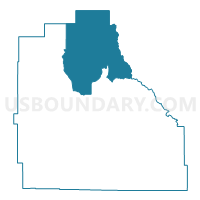
CORA Voting District, Sublette County, Wyoming
About
Outline

Summary
| Unique Area Identifier | 698870 |
| Name | CORA Voting District |
| County | Sublette County |
| State | Wyoming |
| Area (square miles) | 786.33 |
| Land Area (square miles) | 772.86 |
| Water Area (square miles) | 13.47 |
| % of Land Area | 98.29 |
| % of Water Area | 1.71 |
| Latitude of the Internal Point | 43.23938680 |
| Longtitude of the Internal Point | -109.90570740 |
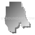
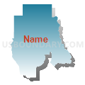
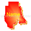
Maps


Graphs
Select a template below for downloading or customizing gragh for CORA Voting District, Sublette County, Wyoming


Neighbors
Neighoring Voting District (by Name) Neighboring Voting District on the Map
- BONDURANT Voting District, Sublette County, WY
- CROWHEART Voting District, Fremont County, WY
- DANIEL Voting District, Sublette County, WY
- DUBOIS Voting District, Fremont County, WY
- FORT WASHAKIE Voting District, Fremont County, WY
- PINEDALE Voting District, Sublette County, WY
- PINEDALE-WEST Voting District, Sublette County, WY
- VISITORS CENTER Voting District, Teton County, WY
Top 10 Neighboring County Subdivision (by Population) Neighboring County Subdivision on the Map
- Jackson Hole CCD, Teton County, WY (20,669)
- Pinedale CCD, Sublette County, WY (6,892)
- Dubois CCD, Fremont County, WY (1,803)
Top 10 Neighboring Place (by Population) Neighboring Place on the Map
Top 10 Neighboring Unified School District (by Population) Neighboring Unified School District on the Map
- Teton County School District 1, WY (21,294)
- Sublette County School District 1, WY (6,932)
- Fremont County School District 6, WY (2,198)
- Fremont County School District 21, WY (2,190)
- Fremont County School District 2, WY (1,898)
Top 10 Neighboring State Legislative District Lower Chamber (by Population) Neighboring State Legislative District Lower Chamber on the Map
- State House District 22, WY (12,218)
- State House District 33, WY (9,942)
- State House District 23, WY (9,763)
Top 10 Neighboring State Legislative District Upper Chamber (by Population) Neighboring State Legislative District Upper Chamber on the Map
- State Senate District 16, WY (23,184)
- State Senate District 17, WY (19,969)
- State Senate District 25, WY (19,502)
Top 10 Neighboring 111th Congressional District (by Population) Neighboring 111th Congressional District on the Map
Top 10 Neighboring Census Tract (by Population) Neighboring Census Tract on the Map
- Census Tract 1.02, Sublette County, WY (5,926)
- Census Tract 9676, Teton County, WY (4,600)
- Census Tract 1.01, Sublette County, WY (4,321)
- Census Tract 4, Fremont County, WY (1,803)
Top 10 Neighboring 5-Digit ZIP Code Tabulation Area (by Population) Neighboring 5-Digit ZIP Code Tabulation Area on the Map
- 83001, WY (15,851)
- 82941, WY (5,028)
- 82513, WY (1,879)
- 83115, WY (830)
- 82925, WY (304)
- 82922, WY (257)